
India Chart
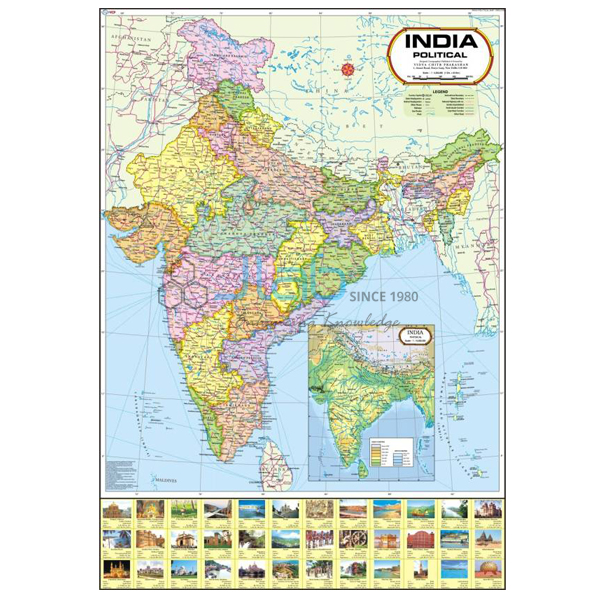
Product Code : JA-MC-3295
JaincoLab's India Chart (SKU JA-MC-3295) presents the map of India as a single large wall chart for school geography classes. It is a wall map chart of India for geography lessons; the listing does not say whether it is a political or physical map, which is confirmed on the quotation. It is laminated, so it can stay on display through the teaching year.
Specifications
This chart is a 70 x 100 cm sheet laminated, and the table below gives the listed values for SKU JA-MC-3295.
| Product | India Chart |
| SKU | JA-MC-3295 |
| Size | 70 x 100 cm |
| Lamination | Laminated |
| Language versions | English only or Hindi only (separate versions) |
| Chart series | Maps Charts |
Applications of the India map chart
- Map reading and location work on India
- Atlas work alongside the wall map
Scope of supply and ordering
Supply is per chart: the India Chart comes as a single sheet. Order quantity, packing and delivery time are confirmed when we quote.
Frequently asked questions
Which language versions of the India Chart are available?
It is listed in an English-only version and a Hindi-only version; state the one needed when ordering.
What size is the India Chart?
It measures 70 x 100 cm and is laminated.
Related products
See the complete Maps Charts range for other titles in this series.
Request a quote
To request a quotation for the India Chart (SKU JA-MC-3295), use the JaincoLab contact page and state the number of charts needed. Institutions and contractors buying under a tender can also reach us via the tenders page.


