Physical Features of Earth Chart
Product Code : JA-COG-3129
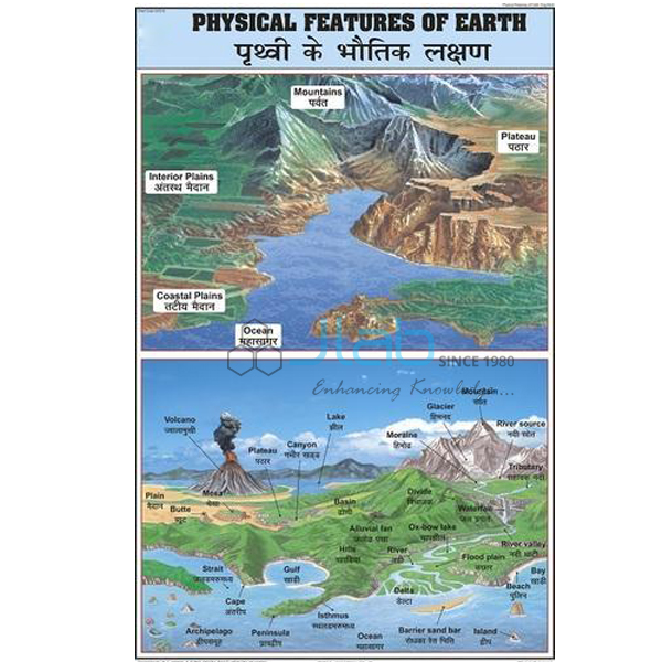
The Physical Features of Earth Chart (SKU JA-COG-3129) is a wall chart on the physical features of the earth for geography teaching. The main physical features of the earth are mountains, plateaus, plains, valleys, rivers, lakes and oceans. Laminated, this physical features of earth chart hangs in a classroom or laboratory as one large shared reference for middle and secondary school geography classes.
Specifications
The Physical Features of Earth Chart measures 50 x 75 cm; the values listed for SKU JA-COG-3129 are set out below.
| Product | Physical Features of Earth Chart |
| SKU | JA-COG-3129 |
| Size | 50 x 75 cm |
| Lamination | Both sides, thick plastic film |
| Chart series | Charts on Geography |
| Language | English and Hindi combined |
Applications of the physical features of earth chart
It is used when the physical features of the earth is taught in middle and secondary school geography classes.
- Identifying mountains, plateaus and plains
- Revision of physical features of the earth before geography tests
Scope of supply and ordering
One laminated chart of 50 x 75 cm is supplied per unit, and other titles from the Charts on Geography series can be added to the same order. Quantities, packing and lead time are set out on the quotation.
Frequently asked questions
Is the Physical Features of Earth Chart printed in Hindi as well as English?
Yes. The product data lists the text as English and Hindi combined.
What size is the Physical Features of Earth Chart?
It measures 50 x 75 cm.
Related products
- Day and Night Chart
- Earthquake Chart
- Latitude and Longitude Chart
- Hill Features, Contours and Map Setting Chart
The full charts on geography range lists every chart in this series.
Request a quote
Send an enquiry for the Physical Features of Earth Chart (SKU JA-COG-3129) with the quantity and delivery destination through the JaincoLab contact page. Tender and project enquiries can be sent through the tenders page.