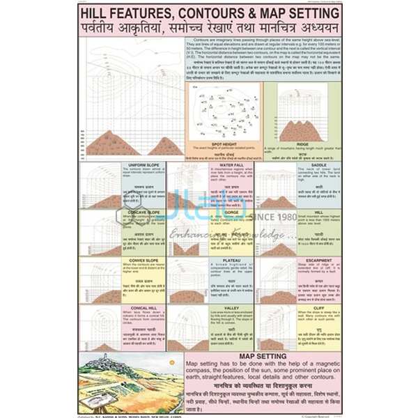
Hill Features, Contours and Map Setting Chart
Product Code : JA-COG-3134
For teachers who want hill features, contours and map setting on the classroom wall, the Hill Features, Contours and Map Setting Chart (SKU JA-COG-3134) is a 50 x 75 cm chart used in middle and secondary school geography classes. Contour lines join places of equal height, and their spacing and shape show hill features such as spurs, valleys, ridges and cliffs. This contours and hill features chart is laminated.
Specifications
SKU JA-COG-3134 is laminated, with English and Hindi text combined and measures 50 x 75 cm; these are the values recorded in the product data for this chart.
| Product | Hill Features, Contours and Map Setting Chart |
| SKU | JA-COG-3134 |
| Size | 50 x 75 cm |
| Lamination | Both sides, thick plastic film |
| Chart series | Charts on Geography |
| Language | English and Hindi combined |
Applications of the contours and hill features chart
Teachers use it for hill features, contours and map setting in middle and secondary school geography classes.
- Reading contours on topographical maps
- Revision of contours and hill features before geography tests
Scope of supply and ordering
Each unit is a single printed chart on hill features, contours and map setting. The quotation confirms the quantity, how the charts are packed and when they can be dispatched.
Frequently asked questions
Is the Hill Features, Contours and Map Setting Chart printed in Hindi as well as English?
Yes. The product data lists the text as English and Hindi combined.
What size is the Hill Features, Contours and Map Setting Chart?
It measures 50 x 75 cm.
Related products
More titles are listed in the charts on geography range.
Request a quote
For a price on the Hill Features, Contours and Map Setting Chart (SKU JA-COG-3134), contact JaincoLab through the enquiry page. Buying under a laboratory tender? Use our tenders page.